Smart Power Grid Inspection
Drone or Unmanned Aerial Vehicle (UAV) is an excellent tool for effective power line inspection and management.
Industry Trend
Utilities spend millions of dollars inspecting infrastructure from power lines to pipelines, which are often in hard-to-reach, dangerous places. However, unmanned aircraft systems (UAS), or drones, are set to revolutionize the way utilities industries solve inspection issues.UAV-based power line inspection is relatively new technology being adopted by the utilities worldwide. Drones enable collecting the needed data for identifying and mitigating risks in power transmission and distribution. Utilities companies are particularly eager to use drones to mitigate hazardous, time-consuming and expensive work.
Xingtera provides a complete UAV intelligent system for power line inspection. That includes UAV, UAV Remote Control Terminal, UAV Inspection System Application SW Platform, Control Center for UAV Live Monitoring and Management, UAV Autopilot Mobile App, and Power Line Inspection Service Platform. Functionally, the system consists of data acquisition in the field, platform for access integration, and data service. Our solution can better monitor sensitive infrastructure for dangerous situations as well as improve distribution reliability. In addition, our solution is field proven and deployed by Tier 1 power transmission businesses in Asia.

What are Challenges in Today's Power Grid Inspection
Power line inspections are always an expensive, time-consuming affair due to difficulties inn realizing safe, efficient and high quality visual and sensor assessments of transmission and distribution towers, bridges, buildings and pipelines.
Solution Overview
Xingtera UAV-based Power Line Inspection solution is an end-to-end solution based on UAV, cloud, and AI. Functionally, it is divided into data acquisition by UAV, cloud platform with environment data and libraries, and AI-enhanced data analysis to pinpoint the failure cause and location.
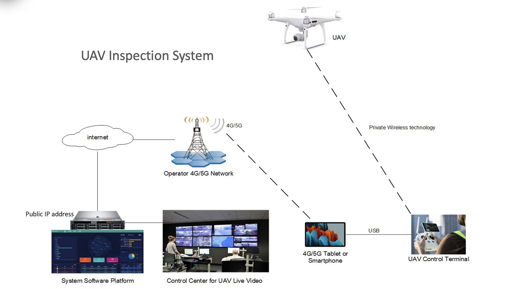
System Overview
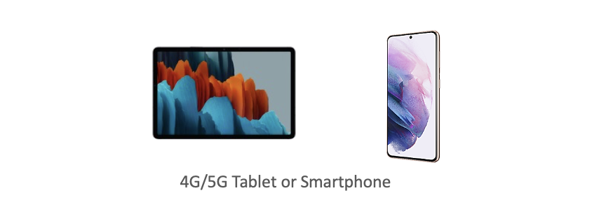
This system consists of UAV, UAV Remote Control Terminal, UAV Inspection System Application SW Platform, Control Center for UAV Live Monitoring and Management, UAV Autopilot Mobile App, and Power Line Inspection Service Platform. They are connected via wireless technologies such as 4G/5G cellular communication network. The figure below shows how the components work together in the system.
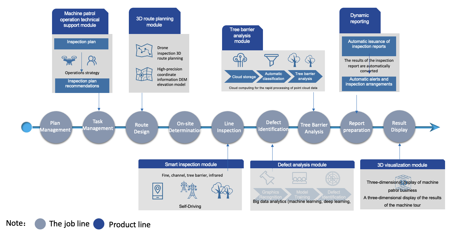
Work Flow
Our UAV-based Power Line Inspection work flow and software platform manage the entire end-to-end service. Functionally, it consists of three key processes as below:
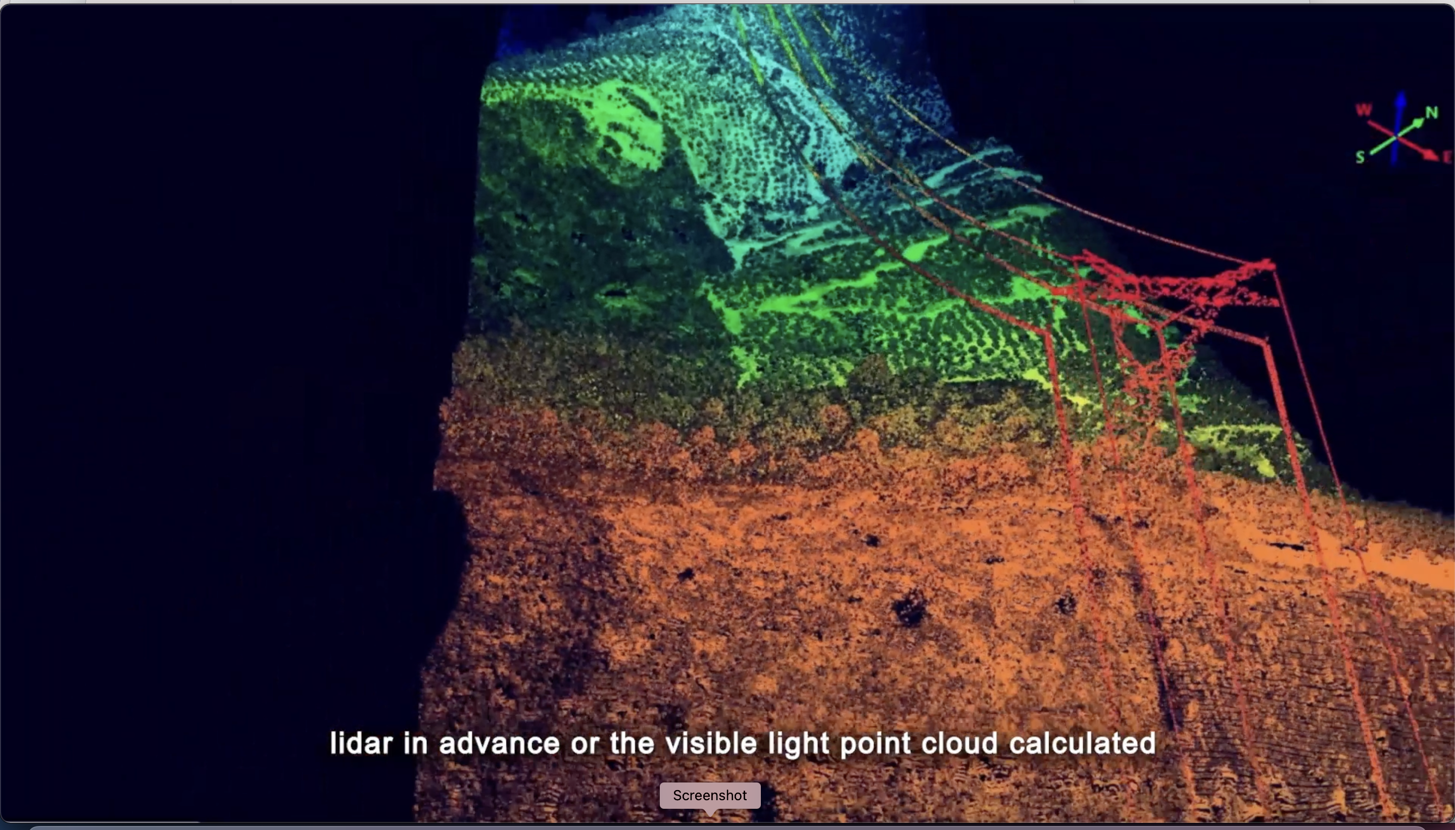
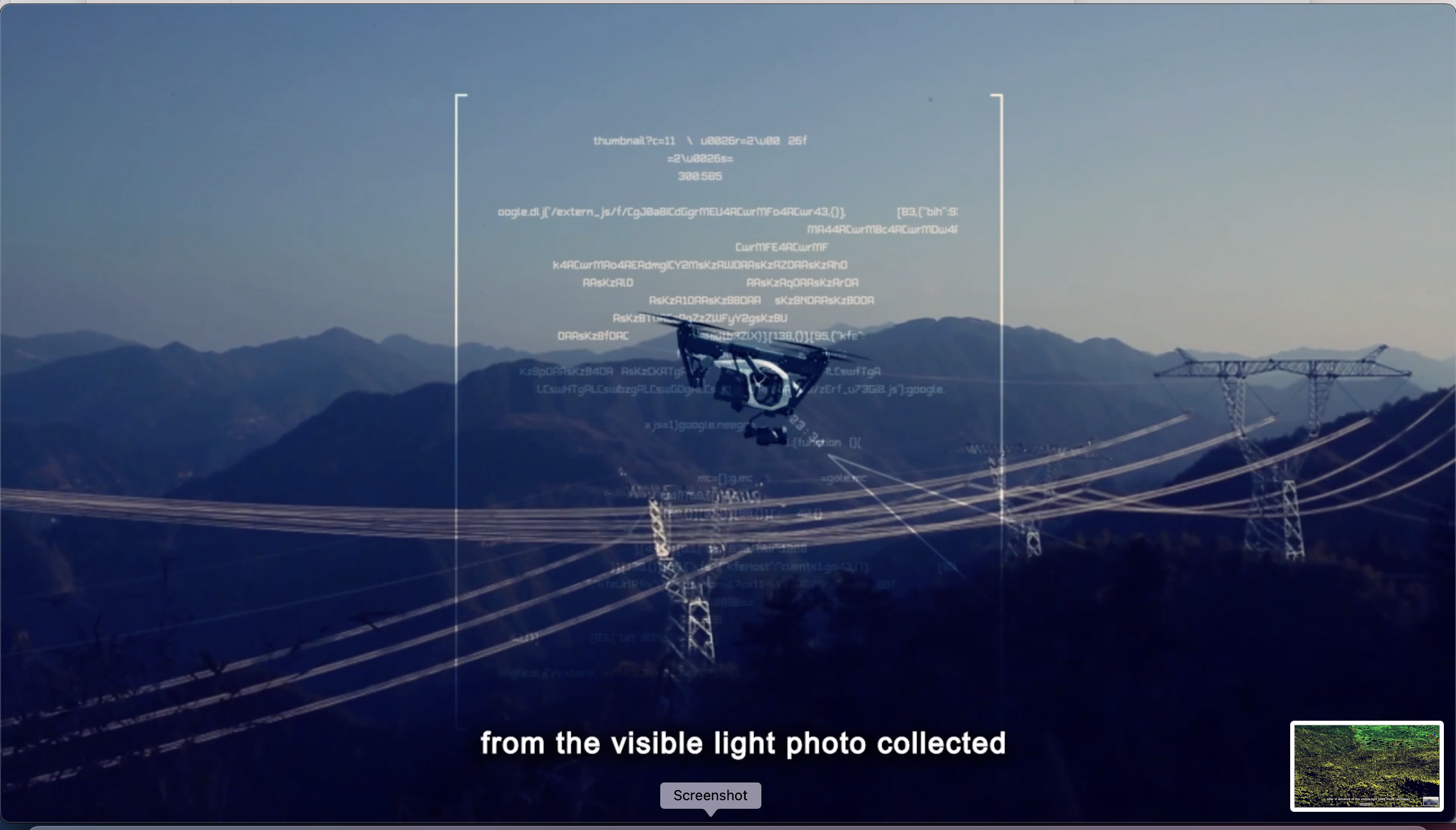
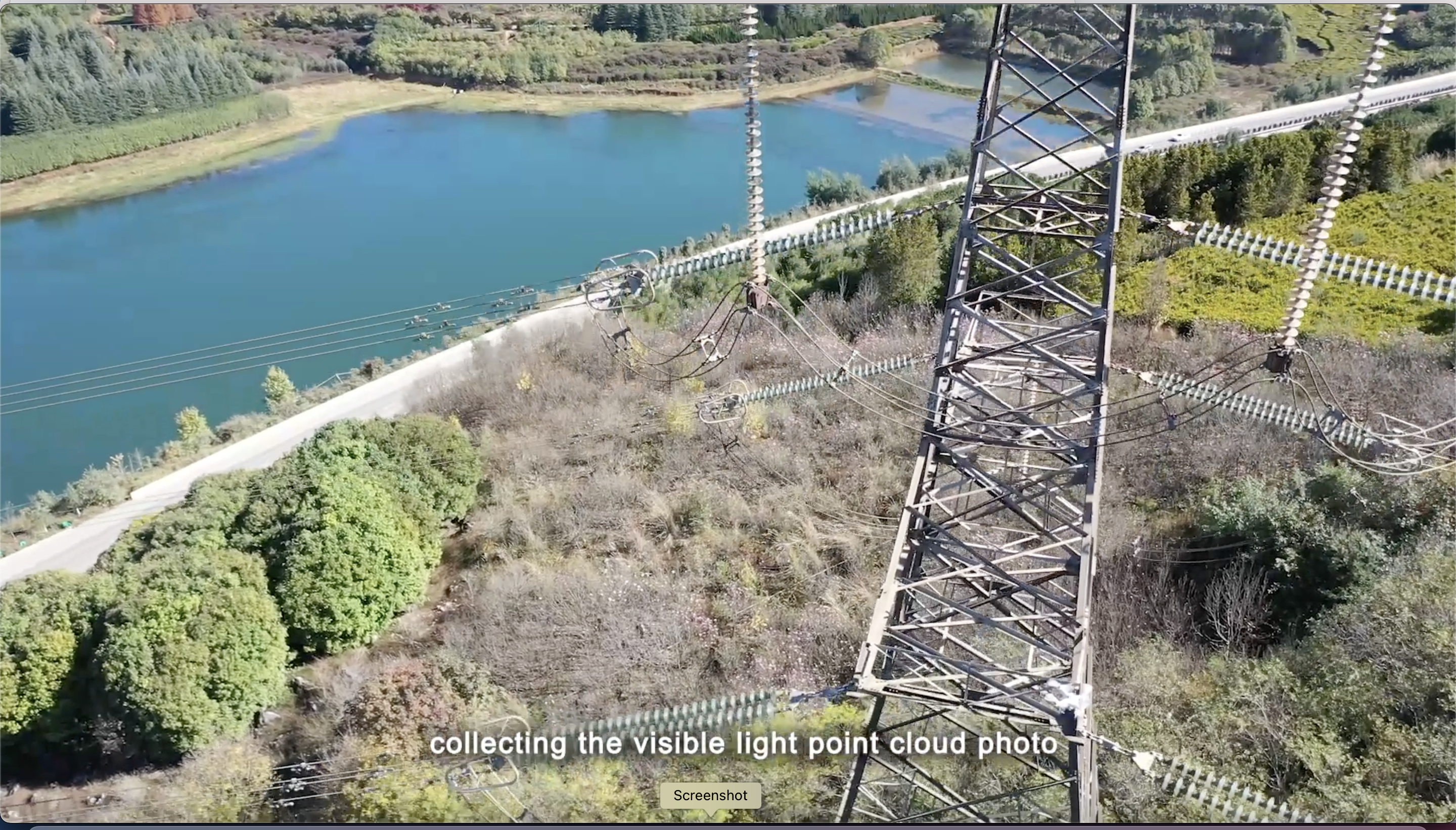
- Data Acquisition— UAV provides data on LiDAR point cloud, photo point cloud, visible photos, infrared photos, and read-time video streaming.
- Access Cloud Platform— Uploads device ledger, task schedule, defects, weather data, civil aviation data, 3D model library, defect library, and route library to UAV to complete its power line inspection tasks.
- Data Analysis Service— It consists of various modules to identify the defect and pinpoint the location of a power line failure.
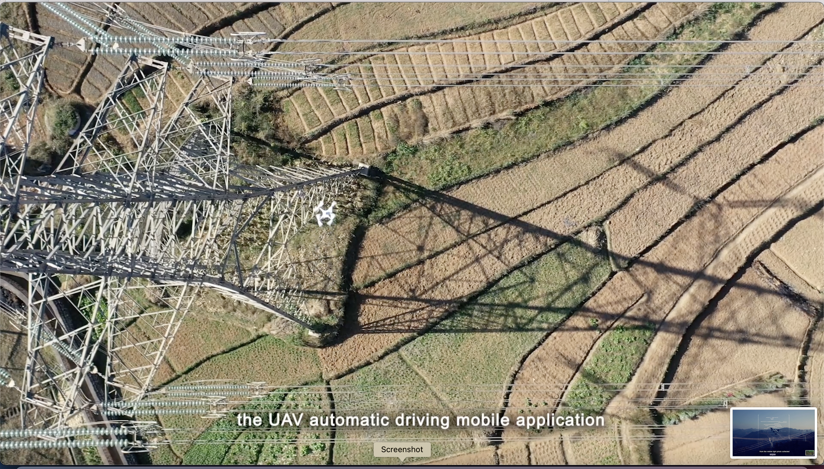
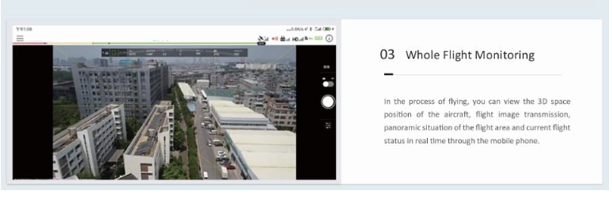
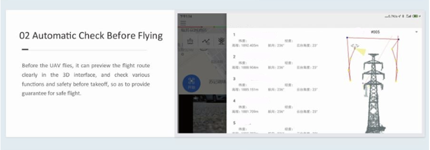
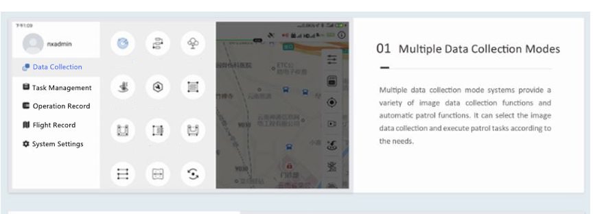
Autopilot Mobile APP
UAV autopilot mobile application is a mobile app that can control the operation of UAV autopilot. It supports Android and iOS platforms and is suitable for various types of mainstream UAV platforms. The autopilot app can be used to control the UAV to independently complete aerial mapping, image collection, visible light point cloud photo collection, patrol operation and Lidar cloud collection.
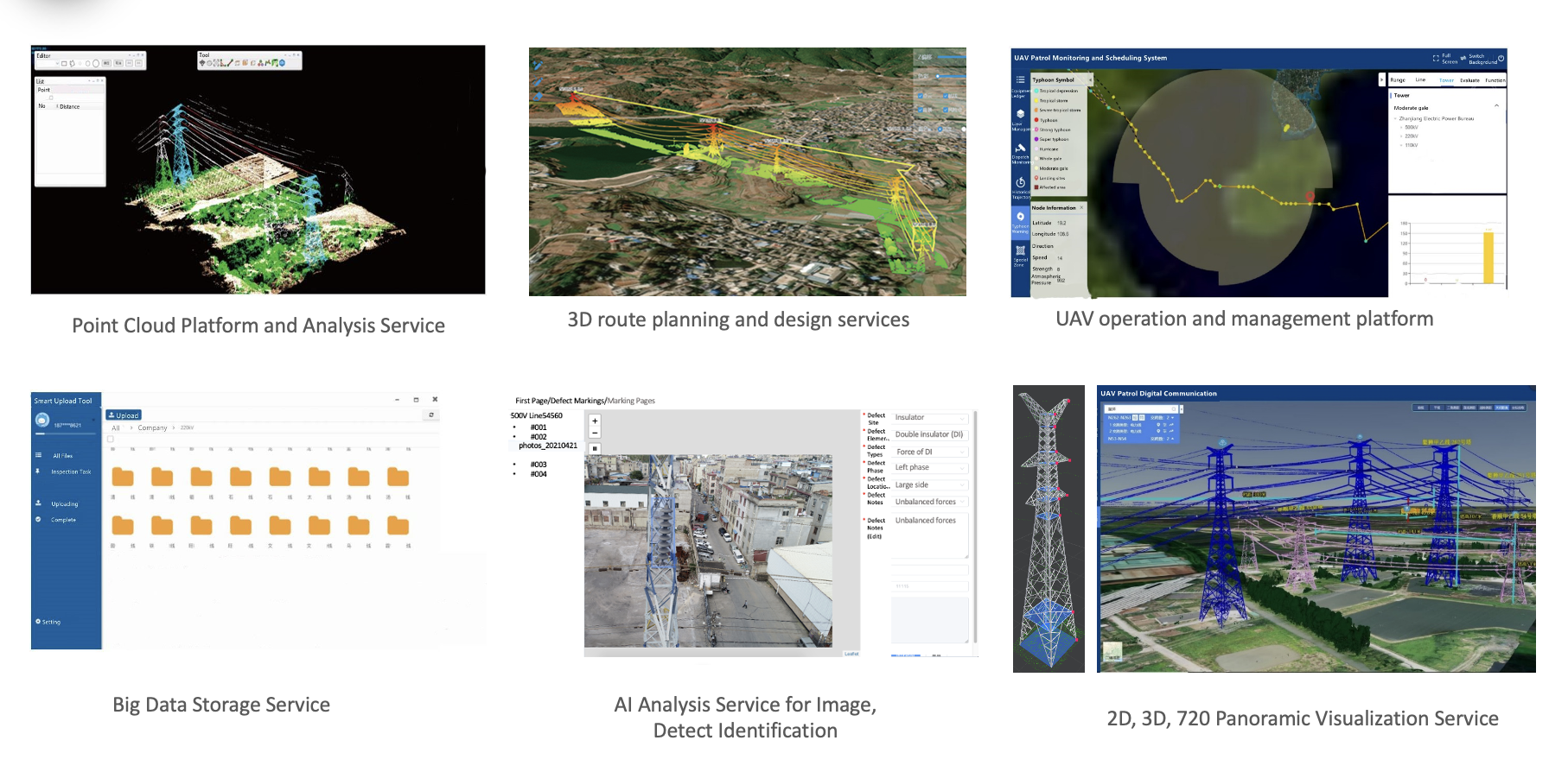
Data Cloud Management
Point cloud file management: support upload point cloud LAS file, link point cloud file according to line account information to a certain line, be able to slice, de noise processing point cloud file, support the selection of point cloud file UTM time zone.
Visible photo management: supports the upload of photos taken for completed job tasks, automatically classifying photos based on longitude and latitude information, and manually classifying photos.
Application Views
Our UAV solution significantly simplifies the power grid inspections and efficiently reduces the costs.